ASHEBORO N.C. – The National Weather Service in Raleigh has issued a Winter Weather Advisory for portions of central North Carolina, including Randolph County. Here is what you can expect.
A period of light freezing rain is set to impact the northern Piedmont, mainly along and north of I-85, from 3 a.m. to 9 a.m. Saturday morning.
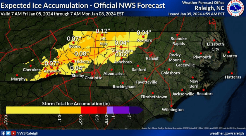
Here in Randolph County, forecasters are predicting around 0.02” of ice accumulation.
Temperatures will remain right near the freezing point through the morning hours on Saturday and any freezing rain is expected to transition to rain by 4 a.m. Total rainfall for Saturday is expected to be around half to three quarters of an inch. The risk of isolated flash flooding cannot be ruled out from Saturday morning through early afternoon.
Combined with wind chill values as low as 25 in the morning hours, Saturday morning will be cold and wet. Impacts on Saturday morning may include slippery sidewalks, roads, and bridges, as well as the possibility of isolated power outages.
Saturday night temperatures are expected to remain just above freezing, limiting the opportunity for wet surfaces to refreeze but some slippery conditions on roadways may still be possible.
N.C. DOT has already begun treating roadways throughout the areas expected to be impacted overnight. Officials are encouraging motorist to stay off the roads overnight if they don’t need to go out and say you can monitor traffic conditions at https://drivenc.gov/. You can also view road closures in Randolph County on our Road Closures & Incidents page here on Randolph News Now.
Find out more about winter weather preparedness and safety on the National Weather Service website.