Thursday, May 9
Shadow

Weather

Tornado Watch Issued as NWS Warns of Severe Weather Threat [UPDATED]

Tornado Watch Issued as NWS Warns of Severe Weather Threat [UPDATED]

Weather
THIS ARTICLE HAS BEEN UPDATEDClick Here or scroll down to see the latest update 
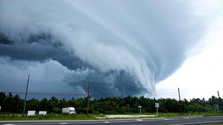
ASHEBORO N.C. - The National Weather Service Office in Raleigh has issued a Tornado Watch admit warnings of the threat of severe weather expected today. The Storm Prediction Center in Norman, Oklahoma, has placed most of central North Carolina under an Enhanced Risk of severe weather today. An Enhanced Risk indicates there is a larger area with widespread chances of low-to-moderate intensity severe thunderstorms. 
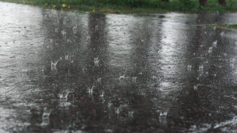
Local forecasters at the National Weather Service Office in Raleigh say that they are expecting a line of severe storms to move across NC between 3pm and 11pm with widespread damaging winds, isolated tornados, and heavy rain causing minor flooding in some areas. As of 2 pm thi...
Dangerously High Temperatures Forecast for Later This Week

Dangerously High Temperatures Forecast for Later This Week

Weather
ASHEBORO N.C. - Forecasters are warning that dangerously hot temperatures are expected across much of central North Carolina later this week and into the weekend. Starting Wednesday and into Thursday, heat and humidity will roll into the area with highs in the lower 90s and heat-index values reaching into the mid-90's. The real threat from dangerous heat starts on Friday and extends through Sunday. Heat advisory and/or warnings are expected during this time as hot temperatures combined with high humidity will push heat index values into the upper 90s to above 100 degrees over central NC, according to forecasters with the National Weather Service in Raleigh. For Randolph County, the hottest temperatures are expected Friday and Saturday with temperatures hanging around 96 deg...
Smoke from Canadian Wildfires Triggers Air Quality Alerts

Smoke from Canadian Wildfires Triggers Air Quality Alerts

Weather
ASHEBORO N.C. - Smoke from Canadian wildfires is bringing hazing conditions across North Carolina and triggering air quality alerts, again. The Forsyth County Office of Environmental Assistance and Protection, located in Winston-Salem, has issued a Code Orange Air Quality Action Day for Fine Particles until midnight on Monday, July 17. Randolph County falls into this area. As of 3 p.m. PM 2.5 levels, which describes fine inhalable particles, with diameters that are 2.5 micrometers and smaller, were at 123 ppb (parts per billion) at the closest air quality monitoring station to Randolph County. That places the county under a Code Orange alert. Code ORANGE is Unhealthy for Sensitive groups meaning children, elderly, and those with lung and/or heart ailments need to limit thei...
NWS Warns of Severe Weather Threat Monday Evening

NWS Warns of Severe Weather Threat Monday Evening

Weather
ASHEBORO N.C. - Forecasters are calling for severe weather including the threat of severe thunderstorms, hail, and an isolated tornado all possible across central North Carolina, including Randolph County, Monday evening. Monday will start off nice with partly to mostly sunny skies and a high reaching near 90 degrees, but an approaching cold front is expected to arrive sometime around 3pm in the afternoon. That cold front brings a serious threat of severe storms across western Piedmont Monday afternoon and into the evening as it develops into a line or large cluster of severe thunderstorms that will move eastward across the area. Those storms are likely to bring severe thunderstorms, including damaging winds, large hail, lighting, flash flooding and a possiable tornado....
Smoke from Canadian Wildfires Trigger Air Quality Alert

Smoke from Canadian Wildfires Trigger Air Quality Alert

Weather
Smoke from Canadian Wildfires can be seen blanketing Asheboro near the Interstate on June 6th, 2023. (Scott Pelkey / RNN-North State Journal) ASHEBORO N.C. - Smoke from wildfires in eastern Canada has triggered a Code Orange Air Quality alert across much of North Carolina, and tomorrow will be worse with officials already issuing a Code Red Air Quality Alert for Wednesday. Wildfires have burned nearly one million acres over the past two weeks across Western Canada, producing incredibly large plumes of smoke that have stretched across the North American continent, making their way into North Carolina throughout today. The smoke plumes are so large that they were captured on NOAA weather satellite imagery on Monday and can be seen in the video below compiled by the Cooperative Inst...
Low Pressure System Promises Rain for Most of Holiday Weekend

Low Pressure System Promises Rain for Most of Holiday Weekend

Weather
ASHEBORO N.C. - After a week of nice weather, a low-pressure system off the coast is promising to bring rain for most of the holiday weekend. According to the National Weather Service Office in Raleigh, an area of low pressure off the Southeast coast will move into the Carolinas over the weekend. Widespread rain, possibly heavy at times, will develop on Saturday and continue into Sunday. This may result in flooding of low lying or poor drainage areas. Additionally, northeasterly winds will gust up to 25 to 35 mph at times on Friday and especially Saturday. Weekend Forecast FridayPartly sunny, with a high near 70. Northeast wind 13 to 15 mph, with gusts as high as 24 mph. Friday NightA slight chance of rain after 2am. Mostly cloudy, with a low around 50. Nort...
NWS Wars of Threat of Severe Storms Tuesday Afternoon

NWS Wars of Threat of Severe Storms Tuesday Afternoon

Weather
ASHEBORO N.C. - The National Weather Service Office in Raleigh has issued a Hazardous Weather Outlook with severe storms expected Tuesday afternoon and into the evening. According to forecasters, strong to severe thunderstorms are possible across much of the Piedmont of North Carolina this afternoon and evening, with the highest risk over the Triad region, including all of Randolph County. Some storms may produce damaging winds over 60 mph, large hail, and isolated tornadoes. The greatestthreat will occur between 3 PM and 10 PM. In addition, isolated flooding is possible where multiple storms pass repeatedly over the same areas. The Storm Prediction Center has placed this area at a Level 2 (out of 5) risk of severe storms. People in this area are urged to check frequ...
Storms Batter Randolph County

Storms Batter Randolph County

Weather
ASHEBORO N.C. - Thunderstorms have battered Randolph County all morning bringing down trees resulting in a few power outages and the threat will continue into this afternoon. This morning at 8:49 am the National Weather Service in Raleigh issued a severe thunderstorm warning for portions of northwest Randolph County. Storm chaser Deniro McKnight posted a video of that cell dropping pea size hail near High Point. https://twitter.com/ChaserDeniro/status/1649761380197646336 A second severe thunderstorm warning was issued just after 10am for the eastern half of Randolph County. Since this morning, the National Weather Service Office in Raleigh has reported three storm damage reports including a tree in the roadway on Columbus Ave at Main St in Archdale, a tree down on I-73 near the...
Raleigh National Weather Service Radar Down for Maintenance

Raleigh National Weather Service Radar Down for Maintenance

Weather
ASHEBORO N.C. - Starting today, April 17th, 2023, the KRAX Weather Radar operated by NOAA's National Weather Service (NWS) in Raleigh, NC, will be unavailable for approximately two weeks for a critical upgrade. The radar is going offline for planned maintenance as technicians refurbish and replace the pedestal, a critical component necessary for antenna rotation and positioning. "The components are extremely heavy and will require the radome to be removed by crane and replaced when the work is completed," said the NWS office in a press release. "The radar and pedestal were designed to last 25 years, and these components have exceeded their projected life span." The KRAX WSR-88D is part of a network of 159 operational radars that make up the nationwide NEXRAD network. Durin...
Statewide Tornado Drill Scheduled for Wednesday March 8th

Statewide Tornado Drill Scheduled for Wednesday March 8th

Weather
Tornado touching down in FL (Stock Photo / Adobe Stock) ASHEBORO N.C. - The National Weather Service along with North Carolina Department of Public Safety and local broadcasters will hold a statewide tornado drill this week as part of Severe Weather Preparedness Week. On Wednesday, March 8th at 9:30 AM, the National Weather Service will conduct a statewide tornado drill. Every school, business, and residence are encouraged to participate in this drill by taking a few moments to practice your severe weather safety plan and seek shelter for a few minutes as if a tornado were headed your way.  The test will come in the form of a Required Monthly Test which will be activated by the State Emergency Alert System and be carried by local radio broadcasters. The statewide drill is part...