Monday, April 29
Shadow

Tag: Weather

Coastal Low to Bring Heavy Rain and Winds Sunday

Coastal Low to Bring Heavy Rain and Winds Sunday

Weather
(irontrybex / Adobe Stock) ASHEBORO N.C. - A strong coastal low system will sweep across central North Carolina Sunday bringing torrential rain and strong winds.  A coastal low-pressure system will begin to move up from the gulf through the southeast coast of the United States, across Florida and Georgia on Saturday and through South Carolina and North Carolina on Sunday.  Impacts 
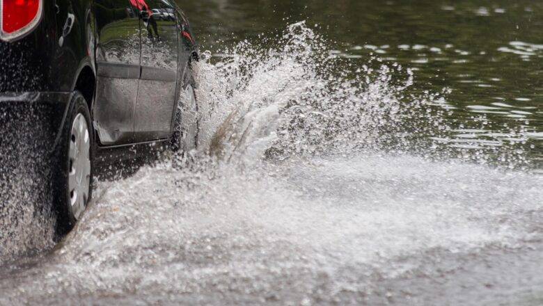
According to the National Weather Service Office in Raleigh the storm will bring areas of heavy rainfall with the potential for localized flooding, especially in urban and poor drainage areas. Rainfall amounts of two to three inches are expected from Saturday night through Sunday night. Gusty winds could knock down tree limbs and blow around light unsecured objects such as holiday decorations...
Dangerously High Temperatures Forecast for Later This Week

Dangerously High Temperatures Forecast for Later This Week

Weather
ASHEBORO N.C. - Forecasters are warning that dangerously hot temperatures are expected across much of central North Carolina later this week and into the weekend. Starting Wednesday and into Thursday, heat and humidity will roll into the area with highs in the lower 90s and heat-index values reaching into the mid-90's. The real threat from dangerous heat starts on Friday and extends through Sunday. Heat advisory and/or warnings are expected during this time as hot temperatures combined with high humidity will push heat index values into the upper 90s to above 100 degrees over central NC, according to forecasters with the National Weather Service in Raleigh. For Randolph County, the hottest temperatures are expected Friday and Saturday with temperatures hanging around 96 deg...
NWS Warns of Severe Weather Threat Monday Evening

NWS Warns of Severe Weather Threat Monday Evening

Weather
ASHEBORO N.C. - Forecasters are calling for severe weather including the threat of severe thunderstorms, hail, and an isolated tornado all possible across central North Carolina, including Randolph County, Monday evening. Monday will start off nice with partly to mostly sunny skies and a high reaching near 90 degrees, but an approaching cold front is expected to arrive sometime around 3pm in the afternoon. That cold front brings a serious threat of severe storms across western Piedmont Monday afternoon and into the evening as it develops into a line or large cluster of severe thunderstorms that will move eastward across the area. Those storms are likely to bring severe thunderstorms, including damaging winds, large hail, lighting, flash flooding and a possiable tornado....
Storms Batter Randolph County

Storms Batter Randolph County

Weather
ASHEBORO N.C. - Thunderstorms have battered Randolph County all morning bringing down trees resulting in a few power outages and the threat will continue into this afternoon. This morning at 8:49 am the National Weather Service in Raleigh issued a severe thunderstorm warning for portions of northwest Randolph County. Storm chaser Deniro McKnight posted a video of that cell dropping pea size hail near High Point. https://twitter.com/ChaserDeniro/status/1649761380197646336 A second severe thunderstorm warning was issued just after 10am for the eastern half of Randolph County. Since this morning, the National Weather Service Office in Raleigh has reported three storm damage reports including a tree in the roadway on Columbus Ave at Main St in Archdale, a tree down on I-73 near the...
Raleigh National Weather Service Radar Down for Maintenance

Raleigh National Weather Service Radar Down for Maintenance

Weather
ASHEBORO N.C. - Starting today, April 17th, 2023, the KRAX Weather Radar operated by NOAA's National Weather Service (NWS) in Raleigh, NC, will be unavailable for approximately two weeks for a critical upgrade. The radar is going offline for planned maintenance as technicians refurbish and replace the pedestal, a critical component necessary for antenna rotation and positioning. "The components are extremely heavy and will require the radome to be removed by crane and replaced when the work is completed," said the NWS office in a press release. "The radar and pedestal were designed to last 25 years, and these components have exceeded their projected life span." The KRAX WSR-88D is part of a network of 159 operational radars that make up the nationwide NEXRAD network. Durin...
Severe Weather Possible Today

Severe Weather Possible Today

Weather
ASHEBORO N.C. - The National Weather Service in Raleigh is warning of the possibility of severe weather today including the threat of an isolated tornado. Forecasters at the NWS are saying to expect rain and wind today with a chance of embedded heavier showers and thunderstorms, a couple of which may become severe, during the afternoon and through the evening. While storms are expected to be isolated, forecasters say those that form will be capable of producing damaging straight line wind gusts. Additionally, southerly winds may gust at times between 30 and 35 mph during the afternoon and evening. New rainfall amounts between a quarter and half of an inch possible. Residents are encouraged to keep an eye on local weather updates throughout the day and stay weather awa...
White Christmas? Probably Not, Say Forecasters

White Christmas? Probably Not, Say Forecasters

Weather
ASHEBORO N.C. - An arctic air system will move into the U.S. this week as forecasters become more confident that there won't be a white Christmas for the Triad. What's Happening? Cold artic air from Siberia will make its way down from Canada thanks to a high-pressure system sometime between Tuesday and Wednesday, reaching the Triad sometime on Friday. Meanwhile, a coastal low-pressure system tracking up eastern/coastal sections of the Carolinas will bring widespread moderate rain into the area Wednesday night and Thursday and into Friday. Credit F5 Weather (https://www.f5wx.com/) In models the arctic low-pressure system is tracking to the north and west of our state with the mountains blocking some of the coldest of the air (and moisture needed for heavy snow) but expect ...
Tonight’s Trunk-or-Treat Forecast

Tonight’s Trunk-or-Treat Forecast

Weather
With several trunk-or-treat events happening across Randolph County tonight, you might want to consider grabbing a jacket on the way out the door. 5 PM PARTLY CLOUDY 61° 7 PM PARTLY CLOUDY 57° 9 PM PARTLY CLOUDY 53° 11 PM PARTLY CLOUDY 52° Expect mostly cloudy/overcast conditions with highs in the lower 60's dropping into the lower 50's before reaching an overnight low of around 47 degrees. Winds to the northeast between 3-8 mph. (From Randolph County Public Health)
NOAA: Winter Forecast – “Warmer, drier South with ongoing La Nina”

NOAA: Winter Forecast – “Warmer, drier South with ongoing La Nina”

Weather
https://www.youtube.com/watch?v=Q9nof83RezU&t=18s ASHEBORO N.C. - The National Oceanic and Atmospheric Association (NOAA) is calling for a warmer and dryer winter this year as La Nina continues. Each year NOAA puts out its yearly winter forecast predictions. This year the governmental agencies forecast which covers December 2022 through February 2023, is calling for La Niña to return for a third consecutive winter. For North Carolina this forecast calls for warmer-than-average temperatures with drier-than-average conditions. “The hardworking forecasters at NOAA’s Climate Prediction Center produce timely and accurate seasonal outlooks and short-term forecasts year-round,” said Michael Farrar, Ph.D., director of the National Centers for Environmental Prediction. “NOAA’s new...
Govt Launches Heat.gov As 30 Million Americans Are Under Heat Advisories

Govt Launches Heat.gov As 30 Million Americans Are Under Heat Advisories

Weather
Heat.gov - Website Screenshot ASHEBORO N.C. (RCSVWX)- Today 38,308,317 Americans are under active National Weather Service extreme heat advisories, watches, and warnings. That number comes from the government's new heat.gov website. The National Integrated Heat Health Information System (NIHHIS) officially launched the site today following an online webinar with news outlets from across the country. Heat.gov is a collaboration of NIHHIS’ federal government partners, including NOAA, CDC, Environmental Protection Agency, Federal Emergency Management Agency, National Institute for Occupational Safety and Health, U.S. Department of Veterans Affairs, U.S. Forest Service, U.S. Department of Health and Human Services, National Institute of Environmental Health Sciences, Occupational S...